FAA Part 107 is the starting point for paid drone work in the United States. Flights supporting a real estate listing, commercial, construction report, inspection, event, or other business purpose need to be planned as commercial operations, not casual recreational flights.
Before takeoff, the pilot needs the right credential and the aircraft needs registration and identification. Airspace, weather, nearby people, roads, obstacles, and temporary restrictions need review for the site and flight time.
At Dronaldo, we run those checks for aerial work from San Diego to San Francisco. A Malibu coastal reveal, an FPV pass through a restaurant, and a construction progress flight in DTLA all operate under the same rules.
The pilot needs an FAA remote pilot certificate
The remote pilot in command for commercial work must hold an FAA Remote Pilot Certificate under Part 107, often called a Part 107 license. The pilot has passed the FAA knowledge test on airspace, weather, operating limits, emergency procedures, and aeronautical decision-making.
The certificate belongs to the pilot, not the drone company or client. A production may have several people on set, but one qualified person must be remote pilot in command and make the final call on whether the aircraft can fly safely and legally.
Part 107 pilots complete recurrent training every 24 months. Rules, airspace tools, and aircraft technology change, so the credential is not something to earn once and forget. We maintain recurrent training as part of our operating work.
Clients should ask who is in command and confirm that the operator is current for commercial work. A capable camera operator may own a drone without being qualified to fly it on a paid job.
The aircraft has its own requirements
Commercial drones generally need FAA registration, which must remain current and available for the aircraft. Every aircraft we use is FAA-registered.
Remote ID broadcasts identification and location information from the drone while it operates. Our aircraft broadcast Remote ID. On a busy location, it is part of operating an accountable aircraft in shared airspace.
Aircraft choice affects what is possible. A small drone may suit a close, controlled property move, while a larger camera platform may be needed for a particular lens, sensor, or production requirement. Operations over people have specific aircraft categories and conditions. We use sub-250 g Category 1 aircraft over crowds. Category 2 and Category 3 work is limited to aircraft declared for those operations and the applicable rules.
Size alone does not decide whether a flight is permitted. The operation, aircraft configuration, and people and property below matter.
Airspace approval is site-specific
Los Angeles shows why a Part 107 card is only one part of the plan. The region includes airport-controlled airspace, heliports, hospital routes, dense urban locations, coastal areas, and changing temporary restrictions. A flight that works at one address may not work a few blocks away.
Before every flight, we check airspace and review Notices to Air Missions, usually called NOTAMs, along with temporary flight restrictions or TFRs. TFRs can appear around wildfire response, major events, security activity, or other situations. A restriction can stop a planned shoot.
In controlled airspace, the operator may need FAA authorization. LAANC, or Low Altitude Authorization and Notification Capability, can often provide authorization in minutes when the location and requested altitude fit available grid limits. Some flights require a request through FAA DroneZone instead. Neither route is automatic, and timing matters.
The general Part 107 ceiling is 400 feet above ground level. It is a ceiling, not a target. Listing shots such as roofline passes, pool reveals, view-corridor rises, and home orbits are often much lower.
Provide the exact address early. “Near LAX” or “in downtown” is not enough for a serious airspace check. A street address, site map, or pin lets us assess the flight area, nearby restrictions, and likely authorization path.
The job still needs a safe operating plan
Part 107 operating limits shape camera work. The remote pilot needs to maintain visual line of sight with the aircraft, directly or with appropriate visual support under the rules. This affects how far a drone can travel behind a building, down a canyon, or through a long warehouse.
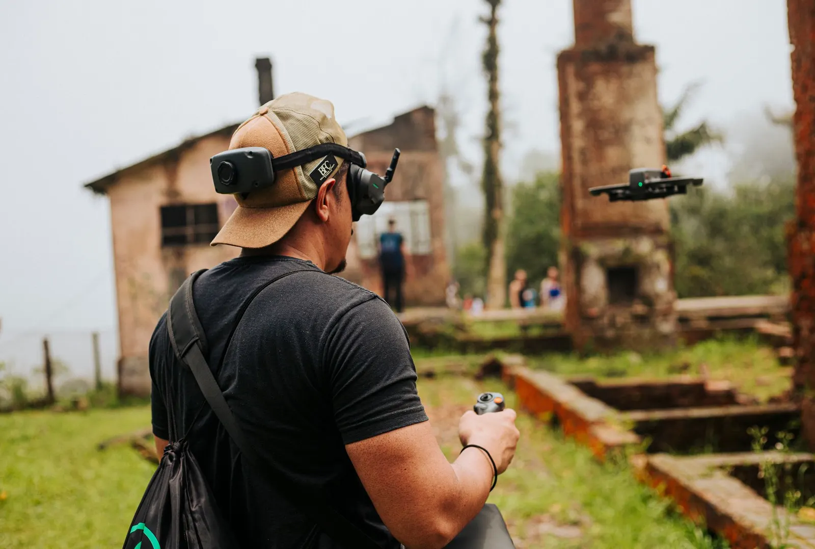
It affects FPV work too. First-person-view goggles give the pilot a camera perspective for a flowing fly-through, but do not remove the visual-line-of-sight requirement. On paid FPV work, we use FCC Part 15 digital links and plan the route, signal conditions, exit points, and visual observation around the site.
Flights near people, vehicles, or public areas require care. A wedding ceremony, active restaurant patio, street-facing listing, and construction site create different exposure. We do not assume a move over a crowd or moving road is available because it would look good. Aircraft category, flight path, access control, permissions, and FAA conditions determine what can be done.
Weather needs planning. Ground-level wind can feel mild while conditions above a bluff, rooftop, or open vineyard differ. Marine layer, heat haze, glare, and low sun affect safety and image quality. Wind and terrain need particular attention on coastal shoots in Malibu, Palos Verdes, Big Sur, or Santa Ynez.
For construction documentation, the plan also protects consistency. Fixed-angle monthly stills help only when camera position, height, and framing can be repeated. Access points, cranes, overhead lines, changing conditions, and active crews need review.
Night work is possible with the right setup
Part 107 permits night operations when the pilot meets applicable training requirements and the aircraft has anti-collision lighting visible for at least 3 statute miles. We are qualified for blue-hour and night shoots and use lighting that meets that requirement.
Night changes the risk picture. Obstacles are harder to see, depth perception changes, and emergency landing areas may be less obvious. A twilight listing shoot needs enough light for the pilot to assess the site while meeting the creative goal. We identify the route and landing options before the light falls.
Night work can suit an illuminated exterior, venue arrival sequence, city setting, or architectural feature. It still requires the same airspace and site checks as daytime work.
Permits are separate from FAA approval
FAA airspace authorization is not permission to film at a location. A drone can legally fly in given airspace while the property owner, city agency, park authority, or production office requires separate approval.
For film and commercial work, that may mean a FilmLA packet in Los Angeles, California Film Commission documentation, or Film SF requirements. We prepare drone packets for those organizations when needed. The production team still needs location permits, access agreements, traffic control, client schedules, and other site obligations.
Private property can simplify access, but does not cancel FAA rules. Public land can add restrictions where airspace is open. Wildlife areas, closed reserves, active fire operations, and sensitive locations need special care. We will not plan flights where a restriction or site rule prevents them.
What to send before requesting a commercial drone flight
Send the address, requested date and time, a description of the shot or deliverable, and any location or production permit information you have. For inspection or mapping work, include the area to be covered and the intended use of the data.
For mapping work that states accuracy, a licensed land surveyor needs to be involved. Drone imagery can support orthomosaics, 3D models, site documentation, and planning, but an aerial operator should not represent it as a survey without the proper surveyor role. For thermal work, the report should be read by a certified thermographer.
Commercial drone work is a camera job, an aviation job, and a site job at the same time. Part 107 provides the baseline. The work depends on applying it to the address, aircraft, requested shot, and conditions on the day of flight.
Comments
No comments yet. Be the first.